
Maple Valley ZIP Coverage
Official sources firmly associate 98038 with the Maple Valley postal city. The King County ZIP map also shows neighboring 98010 around Black Diamond. An exact official address result is still needed before claiming that any part of 98010 falls inside Maple Valley city limits. No other ZIP was verified as serving incorporated Maple Valley. That careful distinction is more useful than a long list of nearby codes.
| ZIP Code | Areas Covered | Post Office | Notes |
|---|---|---|---|
| 98038 | Most incorporated Maple Valley and nearby southeast King County | Verify with USPS | Postal area crosses the city line |
| 98010 | Black Diamond and adjacent south/southeast area | Verify with USPS | Exact Maple Valley overlap is unconfirmed |
| Other ZIPs | Not verified for incorporated Maple Valley | Check exact address | Do not infer from proximity |
The official King County ZIP map supplies the regional view. Pair it with a current USPS result. The city sits east of Kent and Covington, north of Black Diamond, and beside unincorporated county land. Those edges explain why a Maple Valley postal name can lead to either city or county records.
98038 and Maple Valley Records
ZIP code 98038 is the central postal key, yet it extends beyond incorporated Maple Valley. A parcel may use Maple Valley for mail while permits and land-use files remain with King County Local Services. Keep separate fields for postal city, ZIP, situs address, jurisdiction, parcel identification number, legal description, and tax mailing address. A situs address is the physical location assigned to land. A taxpayer mailing address can be somewhere else.
This boundary quirk is why ZIP research should begin with an exact address. USPS answers the mail question. The county map answers the parcel question. City and county boundary sources answer which office has jurisdiction. None of those facts alone proves who currently occupies a home.
98010 Near Maple Valley
ZIP code 98010 belongs to the Black Diamond postal area south and southeast of Maple Valley. It is useful as a neighboring search zone when a family, road, or parcel appears near the boundary. The research did not produce a stable official result proving the exact part, if any, within Maple Valley. Verify the individual address instead of drawing a line from memory.
Main corridors such as SR 169, SR 516, Witte Road, and SR 18 can orient a map search, but road proximity does not set jurisdiction. Select the parcel in King County Parcel Viewer, record its 10-digit PIN and agency context, then use postal results only for mailing geography.
Verify Maple Valley ZIP Codes
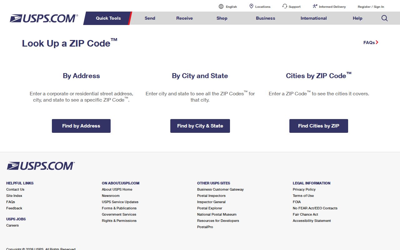
The USPS ZIP Code Lookup offers three useful modes: address to ZIP, city and state to ZIP choices, and ZIP to associated city information. Address mode is best for a resident search because it can return a standardized ZIP+4. City mode may return several codes and still needs an exact address.
| USPS field | Type | Required | Use |
|---|---|---|---|
| Company | Text | No | Optional name |
| Street Address | Text | Yes | Exact number and street |
| Apt/Suite | Text | No | Unit detail |
| City | Text | Yes | Postal city, not city limit |
| State | Dropdown | Yes | Select Washington |
| ZIP | Text | No | Optional narrowing |
The lookup screen makes each postal mode visible before a search.
Find Maple Valley Residents by ZIP
No verified local portal offers a simple public list of every resident in one ZIP. Search by ZIP code works as a narrowing method. USPS confirms the address, maps place it, and official indexes then accept a person, parcel, date, or record number. This Maple Valley ZIP code directory keeps that order clear.
- Enter the full address in USPS and save its standardized postal city, ZIP, and ZIP+4.
- Open King County Parcel Viewer and locate the address or parcel. Note the PIN and jurisdiction.
- Use the assessor's address, parcel, or owner search. An owner is not proof of every occupant.
- For recorded documents, convert the address to the parcel number or legal description before using Landmark.
- For a known voter, use My Voter with its identity fields. It is not a ZIP-wide public roster.
eReal and Parcel Viewer focus on address, parcel, owner/property, and map selection rather than a whole-ZIP export. Landmark searches parties, parcel numbers, legal descriptions, dates, document types, and recording details, not a browseable ZIP. Once the area narrows to a road, the Maple Valley street directory covers the street-level chain.
Maple Valley ZIP Portal Limits
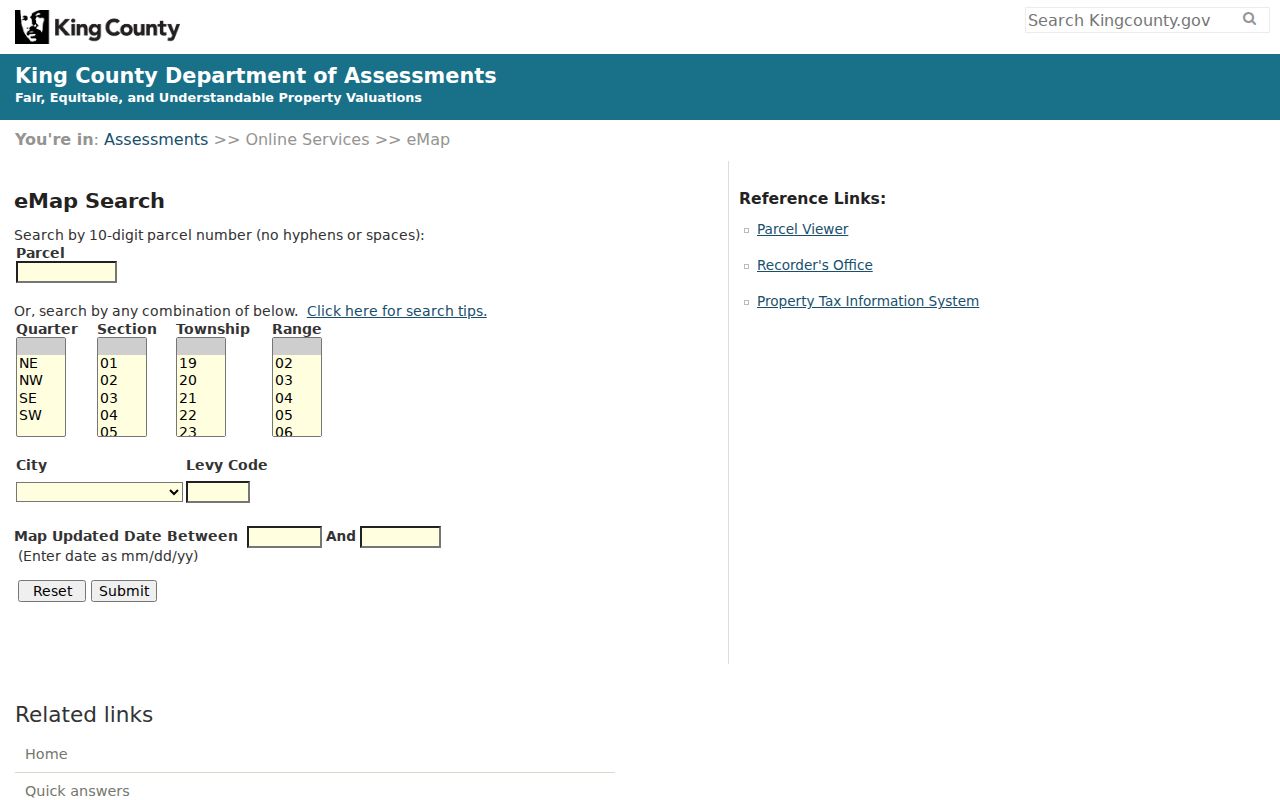
King County eMap uses a 10-digit parcel number, Public Land Survey System fields, levy code, and map date. It can place land but is not a ZIP census. The county permit portal supports address, parcel, and permit-number searches for unincorporated work, including online records and applications since 1996. No ZIP filter was confirmed there.
My Voter asks for any three of first name, last name, date of birth, and house or building number. It has no ZIP field in the personal lookup. The public voter-file request is a different route with state use limits and protected-address omissions. A missing voter result never proves that someone is absent from Maple Valley.
The King County eMap screen shows the actual parcel and geography controls.
Maple Valley Postal and Parcel Keys
A King County PIN has 10 digits. Its first six major digits identify a plat or subdivision, and the last four minor digits identify the parcel. eMap requires all digits with no spaces or hyphens. Special endings such as ROAD, TRCT, UNKN, and condo 0000 can appear, so a value unlike a house number may still be valid county data.
- ZIP code
- A postal delivery area, not the Maple Valley city line.
- ZIP+4
- A more precise USPS delivery segment.
- PO-box ZIP
- A postal use centered on boxes rather than standard street delivery.
- Unique ZIP
- A code for one high-volume organization; none was verified here.
- Carrier route
- A delivery path within a ZIP, not a city district.
The PIN is often more stable than a street label, though parcel splits and merges can change it. Preserve the old address, legal description, map date, and source date in historical research.
Maple Valley ZIPs Versus City Limits
A ZIP boundary serves mail. The Maple Valley city limit defines municipal authority. A postal city is the accepted place name in an address. Those shapes overlap without matching. The key myth to avoid is that every 98038 address lies inside incorporated Maple Valley. Nearby unincorporated parcels can use the same postal identity and follow county permit workflows.
- Postal answer
- Use USPS for the standardized city name, ZIP, and ZIP+4.
- Parcel answer
- Use the assessor and Parcel Viewer for PIN, situs, and mapped land.
- Jurisdiction answer
- Use city and county boundaries to choose the right records office.
- Historical answer
- Use the address and boundary evidence that existed when the record was made.
No dated Maple Valley ZIP realignment was verified. Old directories and census maps may use rural routes or Cedar River, Hobart, Kent, Renton, Tahoma, or Black Diamond. Do not place a modern ZIP on an old entry without evidence. Maple Valley incorporated in 1997, so many earlier records belong to county and community systems.
This cross-check directs city requests to Maple Valley only when city authority applies, and county requests to King County when the postal area extends outside it. Record the date and source for each result because postal and parcel data can change.