
Maple Valley Neighbor Record Sources
The public trail around a Maple Valley block is layered. Parcel Viewer establishes which lots touch or face the same street. eReal adds the taxpayer and property context for one parcel at a time. Deeds establish recorded ownership, permits show work or inspection files, and voter records can confirm only a known registrant under their own rules. No source is a live census.
| Source | What It Shows About a Block | Access |
|---|---|---|
| Parcel Viewer | Parcel shapes, PINs, layers, selected-parcel export | Free; not a survey |
| eReal | Taxpayer, situs, mailing, value and building context | Free; no household roster |
| Landmark | Recorded deed and instrument parties per parcel | Free index; copies and archives separate |
| Accela | Unincorporated permits and inspections | Free search; online history from 1996 |
| My Voter | A match for one known voter | Three of four fields; no street browse |
| Reverse directory | Past occupants where an edition covers the area | Library, archive, selected digital runs |
| Community source | Public meetings, projects, and programs | No verified citywide member directory |
Owner and occupant must remain distinct. A tax mailing address can be outside Maple Valley, and the owner may not live at the situs address. Renters and household members do not appear merely because the parcel was found.
Map Maple Valley Neighbors
The King County Parcel Viewer is the main block tool. Search one address, click its parcel, and zoom out only far enough to see road frontage and shared boundaries. A parcel that touches at one corner may not be a practical neighbor. The map itself warns that its geometry is for general location and is not a survey.
- Enter the subject address and confirm its 10-digit parcel identification number.
- Turn on parcels and address points, then inspect the subject lot's street frontage.
- Click each adjacent parcel and follow its eReal link for the public property report.
- Use the line or area selection tool for a small block run and export selected parcel data.
- Record PIN, situs, legal description, and jurisdiction before checking deeds or permits.
The simple flow is address to parcel map to adjacent PINs to eReal reports to recorded deeds. Keep it small. For every parcel along a named road and the full address record chain, switch to the Maple Valley street directory.
Maple Valley Parcel Viewer Controls
The viewer can search by parcel number, address, or condominium name. Clicking a parcel opens a summary and links to eReal and district information. Selection tools can draw a line or area across several lots, while layers add zoning, address points, districts, and development conditions. Standard, aerial, topographic, and hillshade basemaps help clarify different features.
| Control | Block use |
|---|---|
| Address search | Centers the known Maple Valley address |
| Parcel click | Opens the PIN and parcel summary |
| Select parcels | Builds a small line or area set for export |
| Address-point layer | Checks whether displayed points match the frontage |
| Aerial basemap | Adds visual context but does not prove a boundary |
The map image assigned to this topic comes from the same official source. View the live King County parcel map before relying on the captured interface.
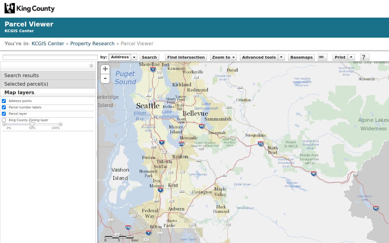
The image shows the parcel-centered interface used to move from one known address to the lots around it. Current layers and controls may change, so the live viewer governs.
Note: Use a recorded plat or survey for a boundary dispute; the online parcel layer is only a general-location reference.
Maple Valley Owners and Occupants
eReal can show the taxpayer or owner, situs address, mailing address, legal description, lot and building facts, assessed values, sales history, and exemptions where displayed. These fields help compare adjacent parcels. They do not list every adult, child, renter, guest, or other household member.
A deed adds another evidence level. It proves that named parties took part in a recorded instrument on a certain date. It still does not prove current occupancy. If the address does not appear in Landmark, use the parcel number, legal description, and owner name. Online recorded-document coverage is generally August 1, 1991 forward; older deeds require King County Archives microfilm.
- Parcel
- A mapped unit of land with a county identification number.
- Situs address
- The location assigned to the parcel itself.
- Mailing address
- The place where the county sends tax correspondence.
- Legal description
- The recorded wording that identifies land beyond its street address.
These distinctions prevent the most common neighbor-search error: turning a taxpayer name into an unsupported claim about who lives inside a Maple Valley home.
Maple Valley Block Permit Clues
The King County Accela portal accepts an address, parcel, or permit number for unincorporated King County. Public results can show status, details, and inspection results without login. Online application history generally reaches back to 1996. A permit is evidence of work or official action at a parcel, not evidence about who occupied it.
Jurisdiction matters around Maple Valley. A Maple Valley postal address may sit within the city or in nearby unincorporated King County. County Accela is the documented route for unincorporated property. For a city permit or code file where no verified public portal is available, submit an identifiable request to the City Clerk under the Washington Public Records Act.
The city and county must give an initial response within five business days under RCW 42.56.520. That response may provide records, seek clarification, cite an exemption, or estimate more time. Include the exact address, date range, and record type.
Maple Valley Neighbor Voter Limits
The My Voter Information portal is not a street roster. It confirms a known person only after any three of first name, last name, date of birth, and house number are entered. A match can show registration and ballot information, but never a person's ballot choices.
The statewide voter database extract is the lawful public-list route. It requires an application and approval, and the CSV has statutory limits. RCW 29A.08.720 restricts solicitation and advertising, RCW 29A.08.740 imposes serious penalties for misuse, and RCW 42.56.070(8) limits commercial lists. Protected addresses must not be republished.
King County Elections offers an office counter, telephone help, email, mail, and public-disclosure requests when the personal portal cannot answer a defined records question. The historic trail is separate: Puget Sound Regional Archives holds King County voter registers from 1916 through 1935, though the research found no complete Maple Valley precinct run.
Maple Valley Community Directory Gap
No official citywide Maple Valley directory of neighborhood associations, HOA members, block-watch rosters, congregations, or civic-club members was found. That gap matters. Private association lists should be treated as nonpublic unless the group itself publishes them, and no names should be inferred from an address.
| Community source | Verified role | Directory access |
|---|---|---|
| City of Maple Valley | Official civic planning and public meetings | No umbrella association index found |
| Maple Valley Historical Society | Local museums, publications, and history | No member roster found |
| KCLS Maple Valley Library | Public programs and research resources | No neighborhood roster |
| Individual associations | No official inventory located | Do not assume member data is public |
The Maple Valley Historical Society can still add place context through Cedar River, fire district, school, veterans, and family-history publications. KCLS offers newspapers, census tools, Sanborn maps, and in-branch genealogy resources. These sources explain a community; they do not produce a current list of neighbors.
Older Maple Valley Neighbor Names
Historical searches must account for Maple Valley's 1997 incorporation. Older records may describe Cedar River, Vine Maple Valley, Tahoma, Hobart, Kent, a rural route, or an unincorporated county area. A modern city label should not be forced onto an older directory or census entry.
Regional reverse directories can sometimes show an address followed by the listed occupant. Seattle Public Library documents reverse-address listings beginning in 1938, but Maple Valley coverage must be checked edition by edition. Washington State Library county, Suburban South, Renton, and Kent runs are other leads. KCLS and archive staff are the fallback when a digital search stops.
A historical directory entry is a publication-time clue. Confirm it with a deed, assessment roll, census schedule, newspaper, or Regional Archives property card. That extra check distinguishes a past block association from a current claim about Maple Valley neighbors.
Official Maple Valley Neighbor Evidence
Official records and commercial neighbor tools are not equal. County sources state who created the record, what date it covers, and how to seek a copy or correction. Commercial tools may combine property, voter, directory, marketing, and public-web data without making those distinctions clear.
| Point | Official county or state source | Commercial category |
|---|---|---|
| Origin | Named public custodian | Combined sources may be unclear |
| Time | Record or update date is often visible | Old and current addresses may mix |
| Meaning | Fields have a defined official purpose | A match may overstate occupancy |
| Correction | Keeper has a request or correction path | Suppression does not change public records |
Use the original record when checking a parcel or getting to know the block. A commercial report is not a block census, and a close name match is not enough to identify a Maple Valley resident.
Privacy for Maple Valley Neighbors
Private block facts remain private. Normal public searches do not reveal all renters, household members, utility or delivery customers, DMV addresses, protected voters, or private association rosters. Washington's Address Confidentiality Program allows qualifying survivors and certain threatened public workers to use a substitute address with agencies.
The program was established in 1991, and 2026 reporting counted 7,802 participants during its thirty-fifth year. A missing address may therefore reflect deliberate safety protection, not bad data. Real residence, city, county, precinct, and identifiers may be confidential. Never try to reconstruct them through nearby parcels or other records.
Lawful use. Look up Maple Valley neighbors only for lawful personal reasons. Never use block information to monitor, harass, threaten, or intimidate anyone.